
What kind of place is Isesaki(伊勢崎)?
The city is located in the southern part of Gunma Prefecture.
The city has long been active in the production of silk. Today, it is an industrial city with many factories.
Isesaki City is the birthplace of Arawi Keiichi. Therefore, the scenery of the city is used as the background of the anime “Nichijou”. As of 2023, the city has the largest number of sacred places for the “Nichijou” anime.
Access to Isesaki
From Tokyo Sta.
Tokyo Sta. → Jouetsu/Hokuriku Shinkansen → Takasaki Sta. → JR Ryomo Line → Isesaki Sta.
In Isesaki City
Isesaki-Shogyo High School(Tokisadame High School)
The high school that Yuko and her friends attend in the anime. It is modeled after Isesaki-Shogyo High School, the alma mater of Mr. Arai.
Please be careful not to disturb the students and teachers as this is where they actually go.
Map
Chimney at SUBARU Isesaki Plant
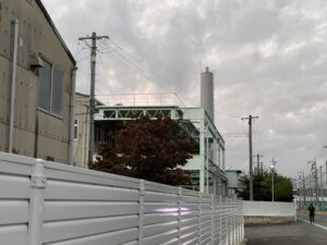
A chimney erected on the premises of the SUBARU Isesaki Plant. It is the model of the chimney where the boy who was blown away after colliding with Nano landed in the first episode.
The background depicted in the animation is original to the animation.
Map
Kezouji-Koen amusement park
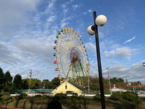
The amusement park where Yuko and Mio went to play.
Map
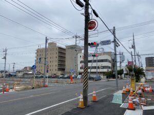
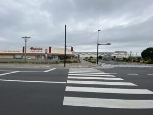
Kazouji-Koen-Mae-Minami Intersection / Nichijou Second OP – Scene where Yuko is standing at an intersection
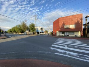
This is the intersection used for the fast turn scene in the second OP of “Nichijou”. Currently, this is the most “Nichijo”-like location in Isesaki City.
Map
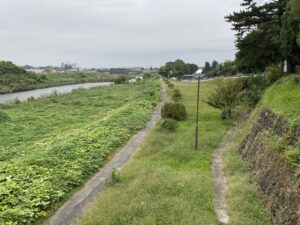
Gunma Prefecture Isesaki Civil Engineering Office / Nichijou Second OP – Scene where Mio is standing at an bridge
A bridge over a river used in Mio’s fast turn in the OP of “Everyday Life”. It is located near the “Gunma-Chubu-Kenminkyoku Isesaki Civil Engineering Office” building.
Map
Under the elevated railroad of the Ryomo Line/Nichijou Second OP – Scene where Mai is standing under the elevated railroad
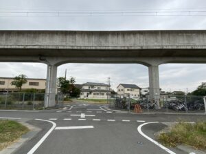
The elevated track of the Ryomo Line used in the OP of “Nichijou” in the second half of the movie, which depicts not only the elevated track but also the ground track and level crossing. It is thought that the scene of the Ryomo Line under construction was used in the OP movie.
Map
Under the elevated railroad of the Ryomo Line / Nichijou Second OP – Scene where Nano is runnig under the elevated railroad
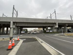
The elevated railroad track right next to Shinonome Laboratory (cleared land). It was used in the scene where Nano runs to the school in the later OP.
Map
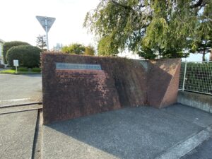
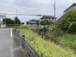
Hirose River bank/Sakae Bridge
The riverbank path where Kiyoshi was chasing Buddy.
It is located on the edge of the Hirose River, under a bridge called Sakae Bridge, which was used as the model for the animation.
Map
Mos Burger Isesaki-Kazoji-Mae sotore / Daiku Burger
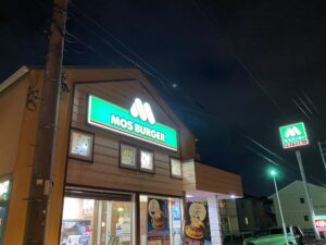
The model store for Daiku Burger. The distinctive trapezoidal shape of the building resembles the scenery in the cartoon.
Map
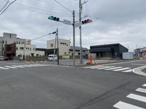
Shinyo-Kinko-Mae Intersection
Background used in the short animation between parts. In the animation, the building on the right (Aio Credit Bank) has been redrawn to be a little longer on the left.
Map
In Maebashi City
Otone-dou Bungu-ten
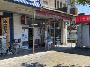
The stationery store used as the background for the cover of the sixth volume of the “Nichijou” comic. The owner’s son is a classmate of Mr. Keiichi Arai, which is why it was used as the cover background.
Inside the store, Arawi’s autograph and Shonen Ace are on display.
Map
スポンサードリンクLocations whose landscape has changed due to redevelopment
Shinonome Laboratory
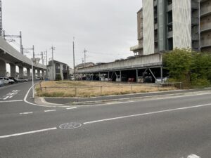
The site was modeled after the land on which the Shinonome Laboratory was built. Currently, the railroad track side is vacant land and the condominium side is a parking lot.
At the time the anime was broadcast, a Japanese-style house similar to the Shinonome Laboratory existed, but it was demolished after the anime finished airing.
The apartment building next door retains its appearance as it was when it was animated, allowing visitors to feel the atmosphere of the anime.
Map
Isesaki-Otemachi Post Office
One of the backgrounds used in the inter-partite short animation. There used to be a post office, but it is no longer in operation and is now a parking lot.
Map
Isesaki-Eki-Mae Intersection
The intersection where Mio was when she happened to witness a line of people dressed in rainbow colors.
Due to ongoing redevelopment, the buildings depicted in the animation have been removed.
Map
Isesaki Station bus stop

The bus stop where Yuko gets off after failing to press the button on the bus. The redevelopment of the area has improved the facilities at the bus stop, so the atmosphere of the place is very different from the one in the anime.
Map
Super Ota (Grocery store)
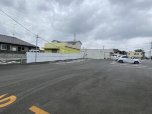
The supermarket where Nakamura ambushed Nanoha. It was closed and demolished, and another store and a parking lot were built.
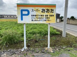
At the time of the author’s visit, the signboard of “Super Ota” remained and traces of it could be seen.
Map
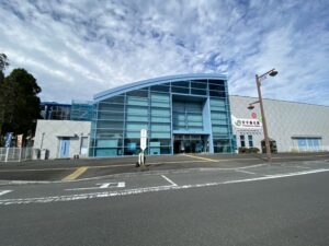
Isesaki Sta.
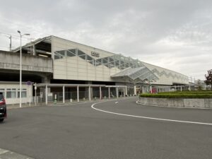
The station is the center of Isesaki City. As of 2023, the old station building has already been replaced by a new one.
Map
スポンサードリンクOthers
Annaka-Haruna Sta.
A station on the Hokuriku Shinkansen Line located in Annaka City, Gunma Prefecture. It is believed to be the origin of the name of the character “Annaka Haruna” from the “Nichijou”
Although it is a Shinkansen station, it is known by railroad fans as an “unexplored” station with nothing in front of the station.
Map
Joshin Dentetsu 700 Series / JR East 107 Series
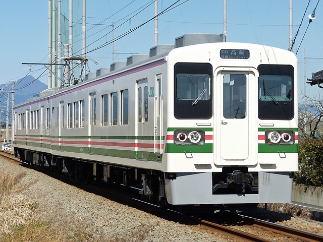
※From Wikipedia(Nyohoho • CC BY-SA 4.0)
A train that appeared in the original story and anime. During the anime broadcast (2011), it was the mainstay of the JR Ryomo Line, serving Isesaki Station (Tokisadame Station). The paint scheme of the train in the anime is from the time when the same train was in service on the Ryomo Line.
Later, it was retired from the Ryomo Line and transferred to the Joshin Line of Joshin Dentetsu Currently, trains of the same form and paint as in the anime are still in operation on the same line.